Navigation Class: Mastering Topo Maps for Alpine Ridges
The allure of alpine ridges is undeniable. The crisp air, the expansive views, the feeling of standing atop the world – it’s an experience that calls to the adventurous spirit. But with this grandeur comes a profound responsibility: the ability to navigate safely and confidently. When you’re miles from the nearest trailhead, often above the treeline, a solid grasp of topographic map reading isn’t just a skill; it’s your lifeline. Welcome to Navigation Class, where we’ll delve deep into mastering topo maps specifically for the unique challenges and rewards of alpine ridges.
The Foundation: Unlocking the Secrets of Topographic Maps
A topographic map is a two-dimensional representation of a three-dimensional landscape. Its power lies in its ability to show elevation and terrain features. The key to unlocking this power? Contour lines.
Understanding Contour Lines
- Contour Interval: This is the elevation difference between adjacent contour lines. It’s crucial information, usually found in the map’s legend. A 40-foot interval means each line represents a 40-foot change in elevation.
- Index Contours: Every fifth contour line is typically bolder and numbered. These are your index contours, making it easier to quickly ascertain elevation.
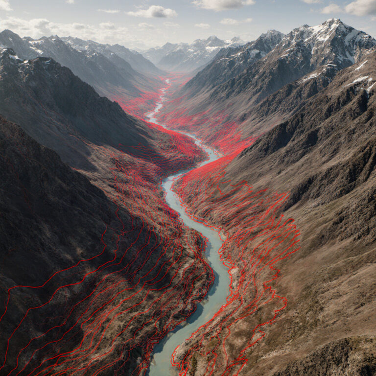
- Closely Spaced vs. Widely Spaced: This is perhaps the most fundamental concept. Closely spaced contour lines indicate steep terrain (cliffs, steep slopes), while widely spaced lines signify flatter, gentler slopes. On an alpine ridge, identifying these differences is paramount for choosing a safe ascent or descent path.
- V-Shapes and U-Shapes: Contour lines form V-shapes when crossing streams or valleys, with the ‘V’ pointing upstream or uphill. They form U-shapes around ridges or spurs, with the ‘U’ pointing downhill. Understanding these shapes helps you discern the direction of water flow and the lay of the land.
Map Scale and Symbols
Every topographic map has a scale, usually expressed as a ratio (e.g., 1:24,000, meaning one unit on the map equals 24,000 units on the ground). This scale is vital for estimating distances. Familiarize yourself with the legend to understand symbols for trails, water sources, vegetation, and man-made features. On an alpine ridge, noting features like rock bands, glaciers, or permanent snowfields, often depicted with specific symbols, can be crucial for route assessment.
Declination and Orienting Your Map
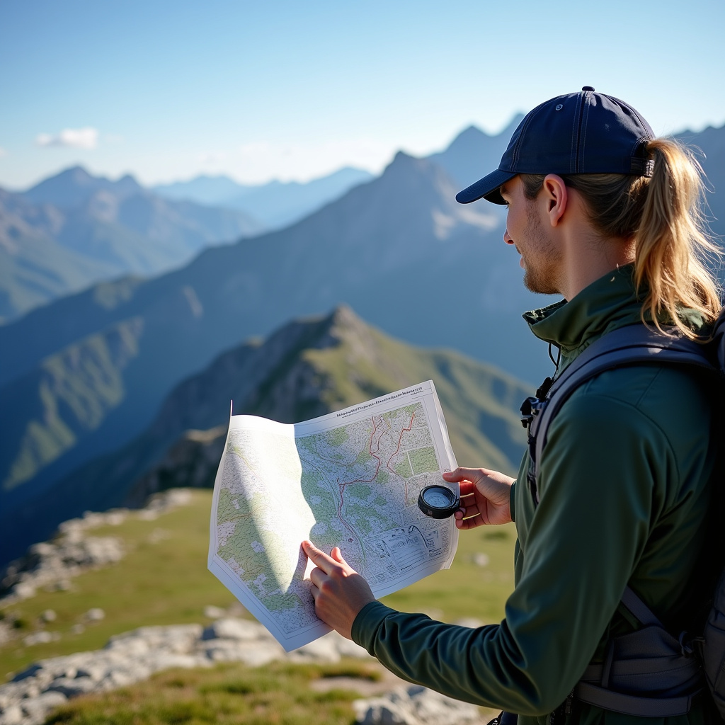
Magnetic North (where your compass points) is rarely the same as True North (the top of your map, or the geographic North Pole). The difference is called declination, and it varies by location. Most maps will have a declination diagram. You must adjust your compass for declination, or orient your map to True North and then use your compass to take bearings relative to the map’s orientation. For alpine travel, especially in whiteout conditions, correctly orienting your map with a compass is non-negotiable for accurate navigation.
Reading the Terrain: Key Features of Alpine Ridges
Once you understand contour lines, you can begin to visualize the 3D world from your 2D map.
- Ridges and Spurs: A ridge is a long, narrow elevation of land. Spurs are smaller ridges projecting from a main ridge. On a map, contour lines typically form U-shapes or V-shapes that point downhill. Walking a ridge offers expansive views but can also expose you to high winds and lightning.
- Valleys and Draws: Valleys are low areas between ridges, often containing watercourses. Draws are less developed, often dry, small valleys or depressions. Contour lines form V-shapes pointing uphill. Descending into a valley can offer shelter but might involve steep, loose terrain.
- Saddles and Passes: A saddle is a low point along a ridge between two higher points or peaks, resembling a horse’s saddle. A pass is a low point in a mountain range allowing passage through. Contour lines will show an hourglass or figure-eight shape, with higher terrain on either side. These are often natural routes through mountain ranges but can be wind tunnels.
- Peaks and Summits: Represented by concentric, closed contour circles, with the smallest circle at the highest point. Identifying true summits vs. false summits on a map helps manage expectations and energy.
- Cliffs and Benches: Closely spaced contour lines indicate cliffs; they may even merge or touch on very steep terrain. Benches are relatively flat areas on a slope, often shown as wider spaces between contour lines. Identifying these helps avoid dangerous drops and find resting spots.
Route Planning on Alpine Ridges
Effective navigation isn’t just about knowing where you are; it’s about knowing where you’re going and the safest way to get there. On alpine ridges, this means meticulous route planning.
Identifying Safe Paths: Use your understanding of contour lines to identify gentler slopes for ascent/descent, avoiding areas of extreme steepness (densely packed contours) or potential exposure. Look for natural “handrails” – linear features like ridges or streams that you can follow. Identify “attack points” – distinct, easily recognizable features close to your destination that you can navigate to, then make a final, short bearing to your goal. Be wary of cornices (overhanging snow formations), which aren’t always explicitly marked but often form on the leeward side of ridges in snowy conditions, especially those with steep drop-offs.
Estimating Distance and Elevation: Use your map’s scale to estimate the distance of your route. Factor in elevation gain and loss using the contour interval to get a realistic idea of the physical effort and time required. A good rule of thumb is to allow more time for elevation gain than for horizontal distance on steep terrain.
Putting It Into Practice: Field Skills
The map is a tool, but your skills in the field bring it to life.
- Relating Map to Ground: Constantly look up from your map and compare what you see around you to the features on the map. Identify prominent peaks, valleys, and the general trend of the ridge. This continuous feedback loop is vital for maintaining situational awareness.
- Pacing and Timing: Learn your average pace over different types of terrain and elevation changes. Use this to estimate arrival times at checkpoints. Regularly check your progress against your map.
- Maintaining Awareness: Don’t wait until you’re lost to consult your map. Periodically stop, take a bearing, and identify your position. In challenging visibility, this becomes even more critical.
Beyond the Map: Backup and Practice
While mastering topographic maps is paramount, it’s wise to carry supplementary navigation tools. A GPS device or a smartphone with downloaded offline maps can be invaluable backups, but never solely rely on them; batteries die, signals drop. Always carry a physical map and compass as your primary navigation system. The best way to truly master map reading is through practice. Start with familiar trails, then gradually move to more challenging, off-trail terrain. Take a dedicated navigation course from reputable organizations like the National Outdoor Leadership School (NOLS) or local guiding services. NOLS offers excellent resources on understanding topographic maps, emphasizing their use in the field.
Conclusion
The ability to confidently navigate alpine ridges using a topographic map transforms you from a mere visitor into an active participant in the landscape. It deepens your connection to the wilderness, enhances your safety, and opens up a world of adventurous possibilities. So, grab a map, hone your skills, and prepare to explore the high country with newfound mastery. The ridges are calling!